
Our Bonita Roads Appear to be Networked to Serve Chula Vista
- Susan Heavilin
- May 6
- 5 min read

Did you know that San Diego County has a Sweetwater Mobility Element Network map for our roadways? It was created in April of 2022 and traffic has not been the same in our rural community.
They have mapped out our roadways and we are basically a thoroughfare between Chula Vista and Eastlake (the most southern area of Chula Vista).

Bonita is only 5.1 square miles in size—5.0 square miles of land and 0.1 square miles of water. Nearly every single inch of this mostly rural area has been bogged down with outsider traffic. No matter what commuter road you use to get to your home—Briarwood, Sweetwater, Central, Bonita or San Miguel—you are joined by 19,000 vehicles daily using our community roads as their short cut to get more quickly to their destination. Read between the lines—speed limits are not a priority to these out-of-town travelers.
Bonita is unique in that we are bordered by freeways on three sides. Interstates 5 and 805 to the west, State Route 54 to the north and State Route 125 to the east.
Key Freeway Systems
State Route 54 (SR 54 / Filipino-American Highway): A major east-west freeway running directly through the northern edge of Bonita/Plaza Bonita area, connecting it to I-5 in the west and SR 125 in the east.
Interstate 805 (I-805 / Jacob Dekema Freeway): Runs north-south just west of Bonita, providing a major corridor for commuting into San Diego and connecting to the border.
State Route 125 (SR 125 / South Bay Expressway): A toll road and freeway connecting South Bay to East County, easily accessible from the eastern part of Bonita.
Interstate 5 (I-5): Located west of Bonita, it provides the primary coastal route through San Diego County.
This information may be found on Wikipedia.
A Little Known Trick
SR 125 —> SR 54 —> I-5
Here's a little known trick I'd like to share with you.
If you're leaving Eastlake and headed north on the SR 125, you will reach an intersection with SR 54. If you head west on SR 54, you will meet connections to Interstate 805 and Interstate 5. You can get everywhere you want by remaining on the freeways! Isn't that amazing? Who knew?
I-5 —> SR 54 —> SR 125
The same works in reverse. Interstate 5 and Interstate 805 connect to SR-54. Travel east and you will run right into SR-125 (north and south) and can head south to Eastlake. Presto! No getting bogged down in Bonita's traffic congestion!
You don't need to use Bonita-Sunnyside roads to get to Eastlake, Chula Vista, San Diego and lands beyond!
Taxpayers spent a MASSIVE amount of moola to construct these State Roads and Interstates for faster travel to their desired destination. Then WHY are they traveling through this little 5-acre patch of land with a residential speed limit?
Bonita-Sunnyside's Roads Most Traveled
The most frequently used roads in our town are the following:
Sweetwater Road
Willow Street
Bonita Road
Briarwood Road
San Miguel Road
Central Avenue
Coral Canyon Road
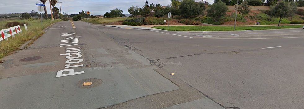
Proctor Valley Road
The two charts below identify these roadways and the "improvement(s)" proposed for each by the County of San Diego.


Why? All of these improvements are of little use to Bonita-Sunnyside residents. The benefit goes solely to Chula Vista and other neighboring communities.
Many of our homeowners moved here for the peace and quiet . . . and the bucolic countryside charm. The horses, walking trails and rural community appeal were all strong attractions.
Bonita is considered a rural and equestrian enclave in the middle of suburbia.—Google
Before the onslaught of daily traffic jams, we weren't in the middle of suburbia.
It was over there with its wide boulevards and concreted sidewalks.
We were over here with our narrow roads where you could stop mid-travel and catch up with a neighbor, our serene walking/equestrian trails with a zillion beautiful horses gaiting by, our birds singing in lush greenery . . . our solitude. Somehow, suburbia creeped into our quiet space.
It's just a matter of time until our little unincorporated area is consumed by the surrounding cities. We are "owned" by the County and are treated worse than a redheaded stepchild.
I once researched incorporating or becoming our own city along with another homeowner. But it is futile. The County gave away our commercial district and beautiful Rohr Park to our neighbor Chula Vista. It's difficult to create an incorporated city without a monetary base.
What Can We Do to "Slow the Go"?
Semi trucks don't belong on our streets. Neither do speeding vehicles or their smelly emissions.
Our children can no longer play safely on their neighborhood streets. You take your life in your hands when you attempt to ride a horse or bicycle or push your baby stroller.
All this traffic can be traced to one dominant source . . . San Miguel Ranch Road dumping into Proctor Valley Road. That's a crucial point where Chula Vista meets Bonita-Sunnyside. Close off that intersection (dead-end it completely) and you remove the greater majority of 19,000 vehicles daily.

There may remain a little non-Bonita traffic but not the overwhelming amounts commonly referred to as "toll avoidance traffic."
I can think of only three solutions but maybe you can offer more.
Close the San Miguel Ranch Road ingress/egress to Proctor Valley Road. Bonita-Sunnyside residents can use the old Proctor Valley Road to travel north, slower and bumpier but definitely worth the discomfort.
Remove the toll on SR 125, encouraging drivers to stay on the State Route and off the neighborhood roads.
Shut down the daily vehicle emissions by making an air quality complaint to the San Diego County Air Pollution Control District. You may report the problem to APCD by calling them at 858-586-2650, emailing apcdcomp@sdapcd.org, or via the mobile app.
I brought this issue up to Supervisor Paloma Aguirre at our last community meeting and she seemed to be in total agreement that we have a traffic pollution problem. And one of her primary goals is to get rid of pollution of all ilk.
Last night's Sweetwater Community Planning Group meeting was canceled by Chair Felix Felix due to "lack of business".
I think that we have plenty of business to discuss, starting with 19,000 vehicles clogging our Bonita roads daily. And I bet we could get a roomful of residents there to talk about it and share ideas. What do you think?


Comments